

How to Read a Map of the USA: A Beginner’s Guide
Reading a map may seem old-fashioned in the age of GPS, but knowing how to read a map of the USA is still a valuable and practical skill. Whether you’re planning a road trip, learning geography, or just exploring for fun, understanding how to read and interpret a map can help you navigate the country with confidence. In this guide, we’ll walk you through the basics—step by step.
Why Learning to Read a Map Matters
Maps aren’t just for travel—they offer insight into the geography, culture, and layout of a place. Reading a map of the USA helps with:
- Understanding geography: Know where states, cities, rivers, and mountains are located.
- Planning travel: See routes, distances, and surrounding areas.
- Improving spatial thinking: Strengthen your ability to visualize locations in relation to one another.
- Studying history and demographics: Maps often show more than just land—they reflect population data, election results, or historical events.
Types of USA Maps You Should Know
Not all maps are created equal. Here are the most common types you’ll encounter:
Political Maps
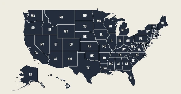
Political maps show man-made boundaries like states and cities. You’ll typically see state borders, capitals (marked with a star), and major cities. These maps are useful for understanding how the country is divided politically and administratively.
Physical Maps
These maps focus on natural features like mountains, rivers, lakes, and elevation. They often use color gradients to indicate terrain—green for lowlands, brown for mountains, and blue for water bodies.
Road Maps
Road maps are commonly used for navigation. They show highways, interstates, cities, and smaller roads. They may also include gas stations, rest areas, and points of interest.
Thematic Maps
These maps show specific data like population, climate zones, or economic activity. They use colors, symbols, and graphs to visualize information across different regions.
Key Features of a USA Map
Before you can read a map, you need to know what to look at. Most maps share common features:
Title
The title tells you what the map is about. For example, “Political Map of the United States” or “Physical Map of the USA.”
Compass Rose
This symbol shows which direction is north. Maps are typically oriented with north at the top, but it’s always good to check.
Scale
The scale shows the relationship between distances on the map and real-world distances. It’s often represented as a line (e.g., 1 inch = 100 miles) or a ratio (1:6,000,000).
Legend (Key)
The legend explains the meaning of symbols, colors, and lines used on the map. For example, a red line might represent an interstate, while a blue area might show a lake.
Labels
Most maps include names of states, cities, bodies of water, and landmarks. These labels help you identify locations quickly.
How to Read a Map of the USA: Step-by-Step
Let’s break it down into simple steps:
Step 1: Look at the Title
Start by reading the title. It tells you what the map focuses on. This will help you understand what kind of information you can expect.
Step 2: Find the Compass Rose
Locate the compass rose to identify which way is north. This is essential for understanding directions and orientation.
Step 3: Examine the Scale
Use the scale to estimate distances between locations. If the scale says 1 inch equals 100 miles, then a 5-inch distance on the map equals 500 miles in real life.
Step 4: Check the Legend
Study the legend to interpret colors, symbols, and lines. For example:
- A star might represent a state capital
- Dotted lines may show hiking trails
- Dark green could indicate national forests
Step 5: Identify Key Locations
Start by locating the 50 states. Then, find major cities such as:
- New York City
- Los Angeles
- Chicago
- Houston
Also look for natural landmarks like: - The Rocky Mountains
- The Mississippi River
- The Great Lakes
Step 6: Trace Routes or Patterns
Use the map to trace road trips, historical routes, or weather patterns. Try following:
- Interstate 80 from New York to California
- The path of the Mississippi River from Minnesota to Louisiana
- Mountain ranges like the Appalachians in the east
Symbols You Might See on a USA Map
Here’s a quick reference guide for common map symbols:
| Symbol | Meaning |
|---|---|
| ★ | State capital |
| ● | Major city |
| ▲ | Mountain peak |
| Blue lines | Rivers |
| Green areas | Forests/National Parks |
| Thick red lines | Interstates |
| Thin gray lines | Minor roads |
Practice Example: Reading a Real Map
Let’s say you’re looking at a road map of the USA. You want to drive from Chicago, Illinois, to Denver, Colorado.
- Find both cities on the map.
- Check the interstate routes (likely I-80 or I-70).
- Estimate the distance using the scale bar.
- Note the terrain—you’ll cross the plains and approach the Rocky Mountains.
- Look for stops along the way using city and highway markers.
By doing this, you turn a simple visual map into a functional planning tool.
Tips for Beginners
- Start with familiar places: Locate your hometown or favorite state to get comfortable.
- Use a physical map: Digital maps are great, but using a printed map can help you understand spatial relationships better.
- Quiz yourself: Try finding all 50 states or tracing a river from source to mouth.
- Compare map types: Look at the same region in a political and physical map to see how features align.
Conclusion
Maps are more than just guides—they are windows into the geography and structure of a nation. By learning to read a map of the USA, you gain a better understanding of its vast landscape, diverse cities, and complex roadways. With practice, you’ll be able to navigate any map with ease and even enjoy the process of discovery.
Whether you’re traveling, studying, or just exploring from your desk, knowing how to read a map opens up a world of information. So grab a map, start exploring, and never feel lost again!